

postdoctoral fellow:
Department of Genetics
 Willem Botes,
 chair: Department of Genetics and Research
and research lead:
DST-Grain SA National Wheat Breeding Platform
In the July 2018 issue the pre-breeding project being conducted at Stellenbosch University’s Plant Breeding Laboratory (SU-PBL) as part of the Department of Science and Innovation-Grain SA National Wheat Breeding Platform was introduced. In part two of the article series the importance of grain characteristics in wheat yield potential was discussed. In this article focus is placed on how the fourth industrial revolution is changing the face of agriculture through automation, looking at the use of unmanned aerial vehicles (UAVs) in crop surveillance and phenotyping.
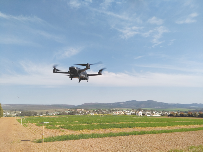
Just a decade or so ago engineering students and technology geeks started to automate previously remote-controlled airplanes and quadcopters – pitching it as an ‘eye in the sky’. The public responded with almost conspiracy-like concerns about the dangers of its use, particularly by the military. Soon, UAVs (drones) became affordable and popular due to its user-friendliness, and people started seeing it for its practical application in numerous fields including agriculture. Nowadays, companies are providing producers with aerial surveillance solutions packaged as sensor-equipped UAVs supported by application-specific software.
Observing one’s fields from the sky might seem very attractive, especially to the technology-inclined or those who are forever seeking smarter farming solutions. But what worthwhile information can one get from using UAVs or is it just another gadget? Using commercially available software or websites, producers can analyse aerial images and obtain information about the general health of their plants, which in turn can be implemented to better manage their fields. While problem areas are highlighted, current solutions do not distinguish between the different types of stress a plant might experience. Be it a lack of nutrients or water, or pests and diseases. Both commercial and research groups are trying to address this limitation and make the data more informative. Another future prospect, actively pursued, is the implementation of aerial images in crop yield estimation.
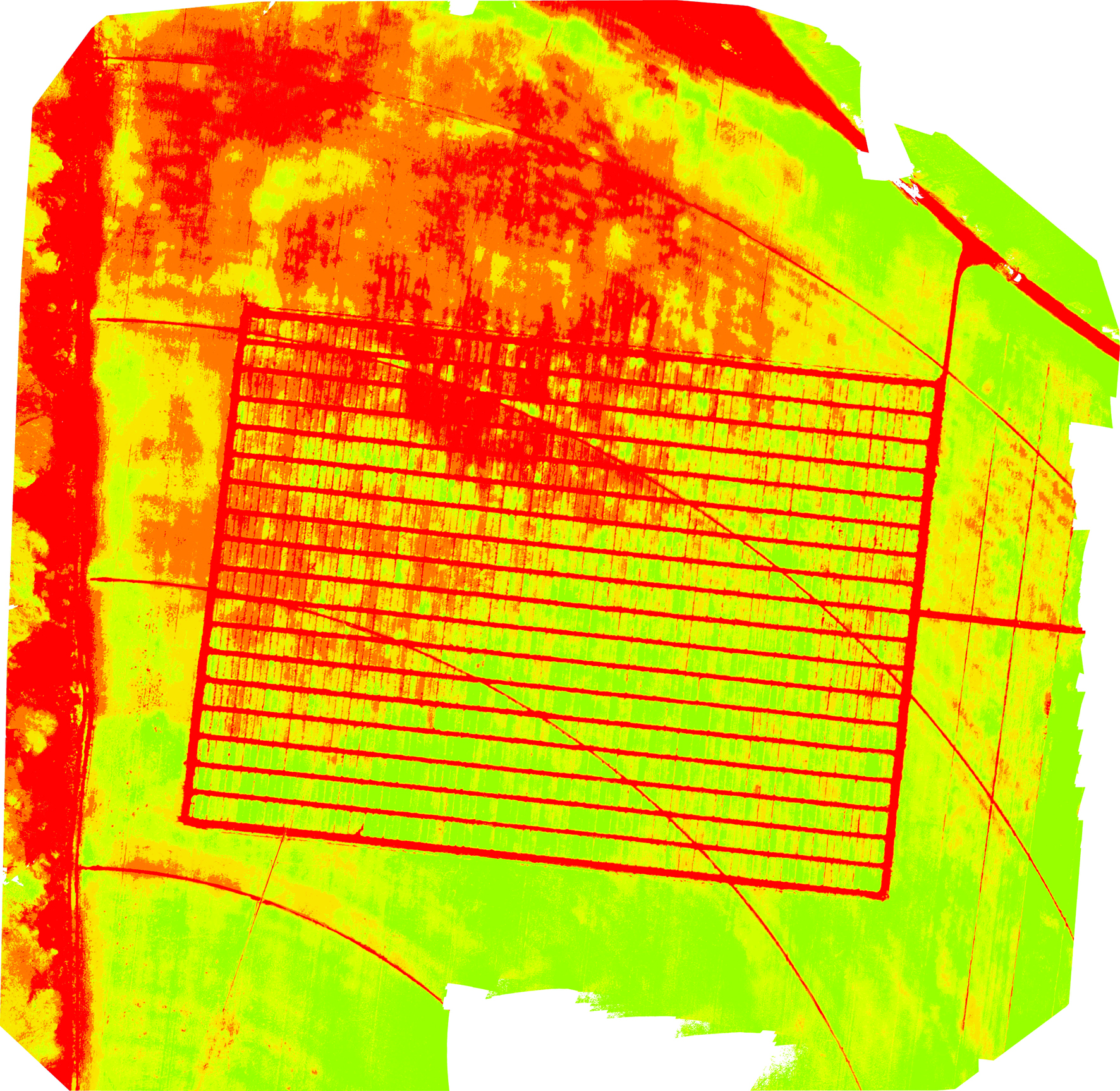
In breeding (or pre-breeding) programmes, the focus is on identifying genotypes (blocks measured in square meters) which show desirable traits, rather than managing cultivation (camps measured in hectares). Unfortunately, this scale difference is making most commercial applications unusable. Various genetically diverse genotypes need to be screened to find the ones with the preferred physical characteristic (phenotype). When it comes to collecting phenotypic data of large field trials, nothing can compete with the use of UAVs equipped with proximal sensors, in terms of speed. Not only does it save time, but it also reduces differences in measurements which may result from the change in sun radiation over the course of the day.
UAVs are fitted with different sensors depending on the information desired. Plant health can be determined using thermal, RGB, multispectral or hyperspectral cameras. Thermal (infrared) cameras can measure the canopy temperature, providing an indication of the plant’s ability to regulate its temperature. The ratio at which plants reflect different light spectra (known as vegetative indices) also gives an indication of the health of the plant. While light detection and ranging (LiDAR) sensors are highly sensitive equipment that can be used to determine crop height and volume, studies have also made use of RGB or multispectral cameras, which are less expensive and can give comparable results. These cameras can also be used to measure the percentage of ground covered by plants.
At the SU-PBL aerial images are used to inspect trials, with the aim to replace ground phenotypic measurements such as leaf area index (LAI), stomatal conductance, chlorophyll content, canopy temperature as well as plant height. This data is coupled to genetic data in order to improve selection in the pre-breeding program. Pipelines have been established to use RGB or multispectral cameras to determine plant health and percentage of ground coverage and height. Thermal data will be added soon. Once these pipelines have been firmly established, they will be made available to breeding companies interested in employing UAV-based phenotyping routinely.
The industry is developing rapidly – and not only internationally. South African start-ups like Aerobotics are leading the way. With the rapid advances, UAVs as well as sensors are becoming better and more affordable. Researchers are also searching for associations between different vegetative indexes and specific phenotypes. With the availability of hyperspectral cameras, capturing short spectral bands across almost the entire spectral range, results can be even more fine-tuned and informative. These findings will hopefully be spun out to producers to keep a closer and better trained digital eye on their fields.


