national marketing
and communications
manager, Fidelity
Services Group
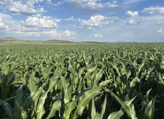
Geospatial innovations such as satellite technology, imagery and geospatial planning have grown in uptake globally and in South Africa. These technologies play an increasingly important role in agribusiness and is commonly referred to as ‘smart farming’.
Although the term encompasses a wide range of technological innovations from drones to mobile apps, the use of geofencing for crops and livestock is gaining increased momentum. Service providers geared to produce soil moisture testing and climate stations, are already able to convey their readings to portable systems such as a mobile phone to produce valuable information on soil and crop conditions for producers. By utilising geofencing technology relevant service providers can aggregate specific information depending on crop type and location.
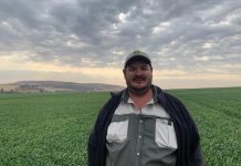
Wahl Bartmann, CEO of Fidelity Services Group, says: ‘Geofencing is the use of GPS technologies to demarcate “fenced” areas without the need for a physical fence. It allows producers to plan crop placement, keep track of livestock and monitor farming conditions over vast areas of land. This technology was implemented to cover the Kruger National Park at just under 20 000 square kilometres – a colossal feat which shows the immense power and potential of smart technologies and geofencing.’
According to Wahl, GPS technology now provides greater accuracy in positioning, communicates using far better communications technology and can assist with securing a competitive advantage in a large number of ways.
Here are a few examples of how GPS can benefit the producer and his farm.
Managing a large number of crops and vast spaces of land can be quite challenging. GPS tracking and monitoring devices can significantly simplify many of these processes, such as the following:
- Crop management
- Soil and fertilisation
- Pest control
- Harvesting
- Livestock tracking and monitoring
‘With GPS-enabled technologies and geofencing, producers can plot out the most efficient and effective routes for their tractors and harvesters to save on time, fuel consumption and labour needs,’ adds Wahl.
Pest control and crop health
By using GPS technologies, producers are able to manage and record geographic location and the spread of pests and disease to effectively manage these problems.
This information is crucial in properly treating affected areas without unnecessarily treating areas that don’t need it, preventing waste. Using weather and other information, producers are able to further determine which areas are more likely to be affected in the future should an outbreak start, thus more effectively protecting crops.
Geofencing to monitor crops and livestock
GPS technology enables producers to create landmarks and geofences around specific geographic locations. This assists with the rotation of livestock through grazing areas, crop planning, planting and harvesting to enhance yield and keep livestock in the designated areas. GPS-enabled animal monitoring and tracking collars and tags are used to keep track of livestock location, grazing patterns and general health through temperature monitoring. This technology can also assist with the protection of livestock and prevention of stock theft by immediately alerting the producer when livestock move out of their designated area.
Further crop data analysis and soil management information can be used to determine whether a specific harvest is performing or not. Information on soil quality, fertiliser dispersion requirements as well as pesticide and herbicide usage can be tracked and monitored for future crop planning.
Ploughing accuracy and field mapping
With the use of GPS and route-tracking technology, crops can be plotted and furrows planned to ensure the most efficient widespread use of available land, regardless of the shape or nature of the field. Precision techniques can take into account existing features such as roads, fencing and buildings to decide on field limits.
Planting and fertilisation
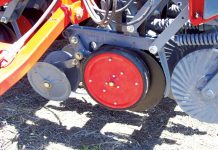
When a field is furrowed, GPS data can be utilised to control precise seed placement. More established strategies for seed sowing such as utilising mechanical spreaders to throw seeds haphazardly over the head of the furrowed field, squander nearly as much seeds as are planted. Such uncontrolled strategies lead to waste and loss of viable crop yield. Notwithstanding precision sowing, GPS technology and geofencing can be applied to fertilisation, soil tests and such to better understand and analyse the area to ensure adequate harvest development. This enables the producer to fertilise specific crops as needed.
Effectiveness
Similarly, as with most other businesses, beneficial cultivation requires proficient utilisation of available assets. GPS-enabled technologies offer various practical options in contrast to more established strategies for planting, raising and reaping crops. Lower costs mean higher likely yields. A higher net income can make the difference between a successful and a failed year. This has motivated many producers to embrace this technology and constantly seek innovative new methods to ensure the success of their livelihoods.
